Connected or Stranded: How Your Street's Place in the Grid Shapes Every Morning You'll Ever Spend There

When prospective buyers tour a home on a quiet residential street, the stillness is often interpreted as a feature. The absence of passing traffic, the unhurried pace of the block—these qualities register as desirable, and rightly so. What buyers frequently fail to examine, however, is the cost of that stillness: how many additional minutes it adds to every commute, how many turns are required to reach the nearest arterial road, and what that cumulative friction ultimately does to the home's resale value.
Street connectivity—the degree to which a given address is integrated into the surrounding road network—operates largely beneath the awareness of casual buyers. Yet transportation planners, urban economists, and experienced appraisers treat it as one of the most reliable predictors of long-term property performance.
What Connectivity Actually Measures
In transportation planning, connectivity is typically expressed through metrics such as intersection density and link-to-node ratios. In plain terms, these figures describe how many routes exist between any two points in a neighborhood and how directly those routes run. A high-connectivity environment offers multiple paths to a destination; a low-connectivity environment funnels residents through a limited number of chokepoints.
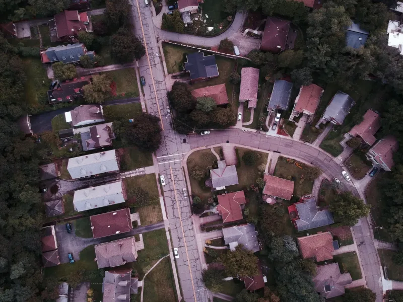
For homeowners, this distinction translates into something immediate and personal: the number of minutes added to a morning commute when a single intersection backs up. In a well-connected grid, drivers, cyclists, and pedestrians can redistribute across alternative routes. In a poorly connected neighborhood—one characterized by looping collector roads, single-exit subdivisions, or the kind of branching cul-de-sac networks common to post-war suburban development—there is no redistribution. Every resident must exit through the same point.
Research published by the Victoria Transport Policy Institute found that residents of low-connectivity neighborhoods spend, on average, 20 to 30 percent more time in their vehicles than residents of comparable grid-connected communities. Over a working year, that figure accumulates into weeks of additional commute time—time that has both a personal and economic cost.
The Cul-de-Sac Calculus
Cul-de-sac living commands a genuine premium in many American markets, and the reasons are legitimate. Reduced through-traffic, enhanced pedestrian safety for children, and a perception of exclusivity all contribute to buyer demand. Studies from the National Association of Realtors have consistently shown that homes on cul-de-sacs sell at a premium of three to five percent compared to equivalent properties on through streets in the same subdivision.
However, that premium carries a hidden ledger entry. Buyers who pay above market for cul-de-sac placement are simultaneously accepting a connectivity deficit that compounds over time. Emergency response vehicles navigate cul-de-sacs less efficiently than grid streets. School bus routing becomes more complex, occasionally leaving cul-de-sac residents outside standard pickup zones. And as remote work patterns shift—returning workers to offices on a partial or full-time basis—the time cost of a low-connectivity address reasserts itself with considerable force.
The calculus is not universally negative. For buyers whose work is remote or whose household rarely requires peak-hour commuting, the cul-de-sac premium may represent excellent value. The error lies in purchasing without performing that calculation deliberately.
Grid Streets and the Underappreciated Premium
Addresses situated on well-connected grid streets—particularly those within a half mile of a transit corridor, commercial node, or arterial road—tend to appreciate more steadily over time, even when their initial sale prices appear modest relative to comparable homes in quieter settings.
A 2019 analysis of residential sales data across twelve mid-sized American cities, conducted by the Urban Land Institute, found that homes within high-connectivity neighborhoods appreciated at a rate approximately 1.8 percentage points higher annually than those in low-connectivity zones. Over a ten-year ownership period, that differential compounds into a meaningful gap in equity accumulation.
The mechanism is straightforward. Connected streets attract a broader pool of potential buyers upon resale—buyers who commute by car, by transit, by bicycle, or on foot. Restricted-access streets narrow that pool. A smaller buyer pool exerts downward pressure on competitive bidding, which in turn moderates final sale prices.
Transit Proximity and the Last-Mile Problem
For buyers in metropolitan markets where rail or bus rapid transit infrastructure exists, the connectivity question extends beyond the road network to what transportation planners call the "last mile"—the distance between a transit stop and one's front door.
Properties within a quarter mile of a rail station command well-documented premiums, often ranging from ten to twenty-five percent depending on the market. But the street layout between a home and its nearest station matters considerably. A property located six blocks from a light rail stop on a direct, sidewalk-equipped grid street effectively enjoys that proximity. The same linear distance, navigated through a subdivision with indirect routing and no pedestrian infrastructure, may feel and function as though the station is twice as far.
Buyers should walk the actual route—not measure the crow-flies distance—before factoring transit access into their valuation of a prospective home.
Questions Every Buyer Should Ask Before Closing
Connectivity analysis need not be technically complex. Before committing to a purchase, buyers are well served by addressing a few direct questions.
First, how many distinct routes exist from this address to the nearest major road? If the answer is one, the household is vulnerable to a single point of failure—whether that failure takes the form of a traffic accident, road construction, or a school-zone backup.
Second, at what time does peak congestion at the nearest egress point occur, and does that timing align with the household's commute schedule? Visiting the street during morning and evening rush hours before closing provides data that no listing sheet will supply.
Third, how has transit service in the surrounding area changed over the past decade, and what planned infrastructure investments—if any—are scheduled for the corridor? A street that currently lacks connectivity may gain it through public investment; a connected street may lose access through infrastructure deterioration or service cuts.
The Address as Infrastructure
At 124 Cline Avenue, we view an address not merely as a location but as a piece of infrastructure—something that either supports or constrains the daily lives of the people who occupy it. A home's connectivity to the wider city is as much a structural feature as its foundation or its roof.
Buyers who account for street connectivity in their purchase analysis tend to report higher satisfaction over the long term, not because they made a flawless choice, but because they made an informed one. The commute you accept on the day you close is the commute you will live with every working morning thereafter. It deserves the same scrutiny you give to the kitchen layout or the condition of the HVAC system—perhaps more.